
Meridian Flight Ops
Meridian crest

Windows desktop · satellite ops desk

MeridianFlight Ops

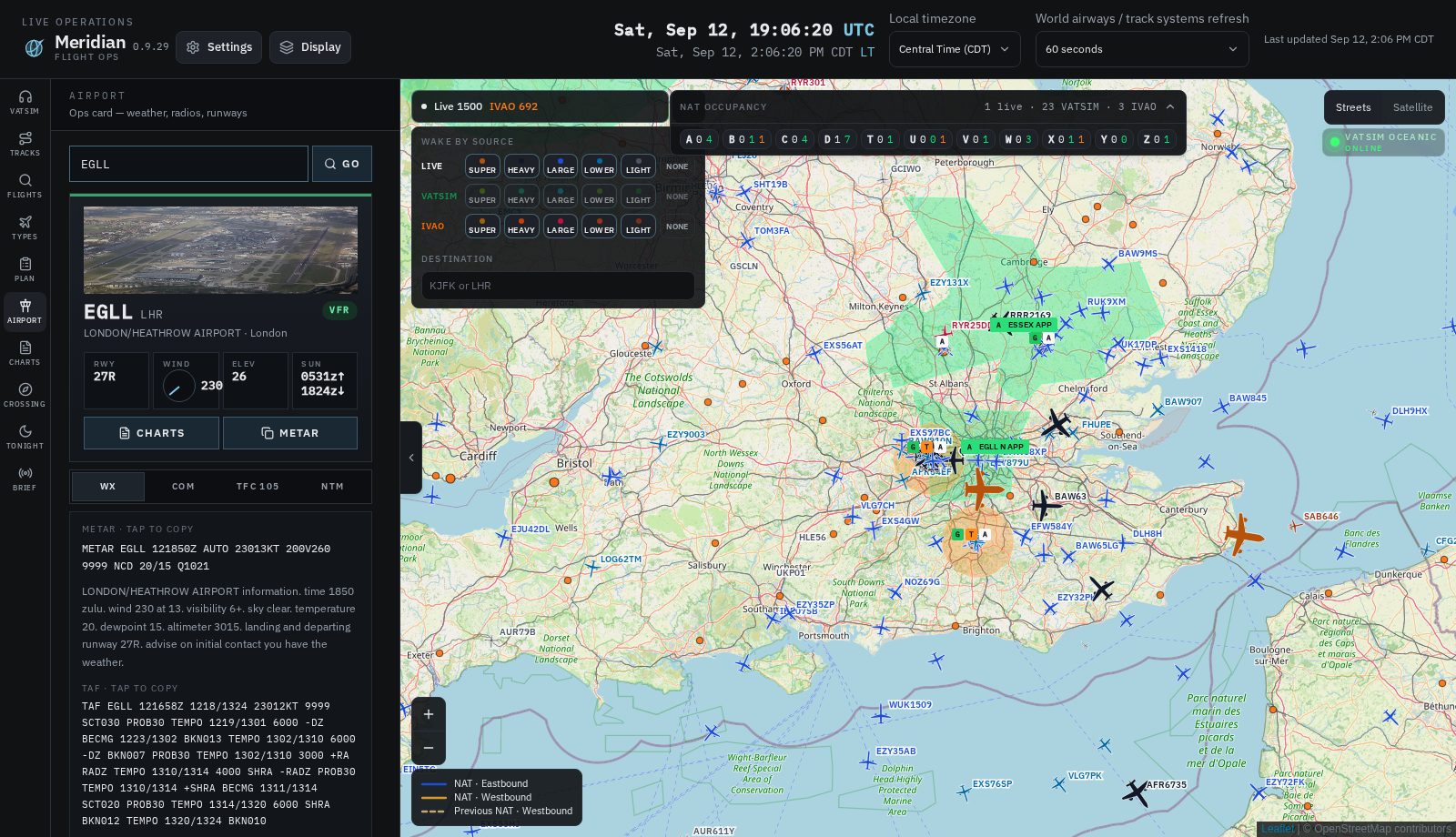
The oceanic desk on Windows. Tonight’s NAT, EUR/SAM, PACOTS, NOPAC, WATRS — in one rail. Then zoom the field: high-quality satellite, your own airplane taxiing with REAL aircraft and the network you fly — VATSIM or IVAO — on the same pavement. This is the homepage. The product is the program you download.

Version 0.10.8 · free while 0.9 is the current desk

Meridian desk: North Atlantic tracks, occupancy, REAL VATSIM and IVAO traffic in one Windows window
The desk: NAT east and west, occupancy, REAL · VATSIM · IVAO. One native window — not a website map.
SatelliteMapTiler satellite + streets v4 — sharp at the gates
Taxi with themYour airplane with REAL, VATSIM, and IVAO on the field
TracksNAT · PACOTS · EUR/SAM · NOPAC · WATRS — current, previous, future
OccupancyREAL · VATSIM · IVAO on each NAT letter, with routes

Only in this window

The desk other maps do not keep.

Occupancy

Who is on the track — by name.

Click NAT D and the strip is a list, not a count: AFR90 on the A350, BAW15K on the 777, DLH410 on the A380, each with the filed string and the city pair. REAL ADS-B, VATSIM, and IVAO are three separate totals.

  • Open the strip, tap a letter, read occupants
  • IVAO is counted the same way as VATSIM — it is not a VATSIM-only widget
  • Click a callsign and that airplane is on the map, tracks still showing
Airport
Heathrow satellite: REAL, VATSIM, and IVAO traffic taxiing with airframe icons

A night on the desk · 1

See your own airplane taxiing. With everyone else.

MapTiler satellite is the ground truth: terminals, paint, the stands. REAL ADS-B airframes at the gates. VATSIM green and IVAO orange on the same taxiways. When MSFS is running, your ownship is on that pavement — not a blue triangle on a blank map.

  • REAL, VATSIM, and IVAO independently, or all three at once
  • Wake Super through Light per feed so the field stays readable
  • Ownship stays up through pause and ESC settings — only the main menu ends it
MapTiler satellite over the city with NAT occupancy, VATSIM online, and an imported flight

A night on the desk · 2

Satellite in the city. Occupancy on the ocean.

Streets v4 or satellite — same MapTiler account, same key on the server. Occupancy is still who is on NAT T tonight, by name. VATSIM listen stays in the corner. Your SimBrief overlay stays loaded while you taxi.

  • Satellite is the close-in view when you want the pavement
  • REAL / VATSIM / IVAO counts sit on the occupancy strip
  • The imported plan does not dump when you zoom the field
EUR/SAM organised tracks UN741 UN857 UN866 UN873 over the South Atlantic

Organised tracks · EUR/SAM

The South Atlantic corridor. Published, not sketched.

SKYbrary EUR/SAM — UN741, UN857, UN866, UN873 — both ways, levels, the waypoint string you copy. Click a lettered route and it is on the map with REAL, VATSIM, and IVAO already on it. This is the same rail as the NAT. It is not a plugin.

  • Valid-from / valid-to on every strip
  • East FL280–FL410 · West FL280–FL410 when the product says so
  • All systems, or EUR/SAM alone
PACOTS and NOPAC organised tracks across the North Pacific with traffic

Organised tracks · PACOTS · NOPAC · WATRS

The Pacific is not an afterthought.

NOPAC composites — R580, R591, CUTEE, KATCH — eastbound over the North Pacific. PACOTS when Japan and the FAA publish them. WATRS L-routes in the west Atlantic. Levels on the line. Traffic on the track. One window for every ocean the sim community actually flies.

  • Numbered PACOTS and NOPAC in the same list as NAT letters
  • Click a route: copy the string, see who is on it
  • Previous and future sets stay visually distinct
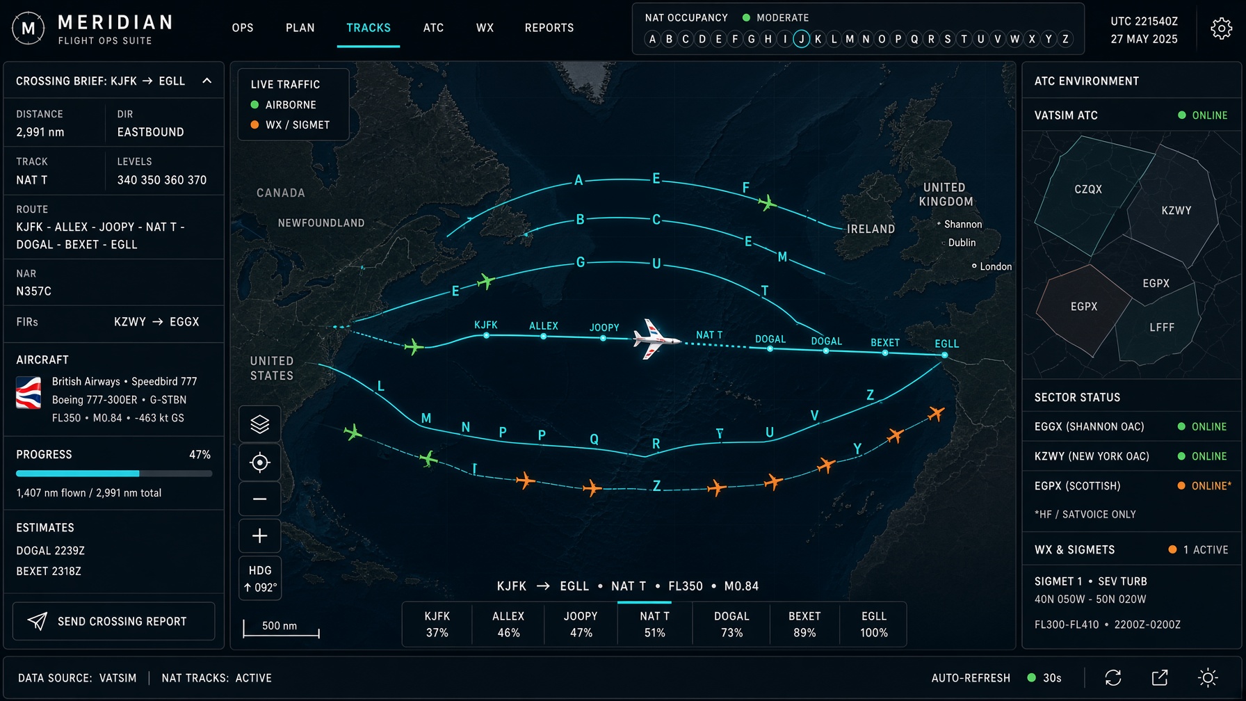
A 777 on NAT Track T with the Meridian crossing brief KJFK to EGLL

A night on the desk · 3

KJFK to EGLL. File it, then watch it.

Build crossing. The desk issues the brief: the organised track, the levels, the NAR into that entry, the FIR strip, the route string you copy into the FMC. Occupancy on that letter is who already went.

  • Same helper for a 40-minute sector and a 3,000 nm ocean
  • Copy into SimBrief or the sim
  • Previous / future OTS stay visually distinct if you leave them on
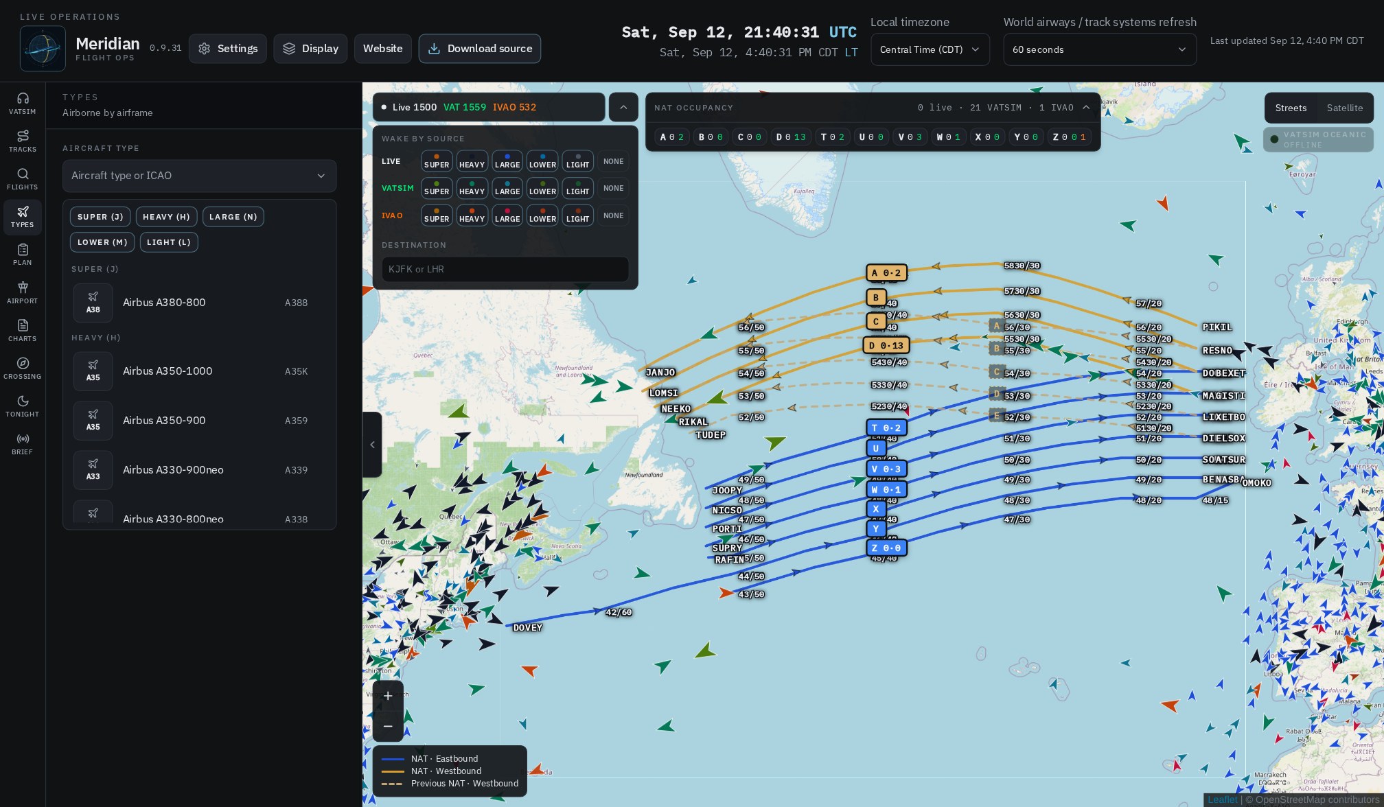
Boeing 777-300ER selected: airborne list with aircraft photos, callsigns, and city pairs

A night on the desk · 4

Every 777-300ER that is up.

Types → Heavy → Boeing 777-300ER. The rail is BAW15K EGLL–KJFK, SIA32 WSSS–EGLL, each with a photograph. This is how you scan a fleet. Flights is the callsign lookup. Both end on the same card: photo, SID, STAR, filed string.

  • Thumbnails in the catalog and on every airborne row
  • ICAO type (B77W) or the marketing name — the filter takes both
  • Plotting one flight does not dump occupancy or the tracks
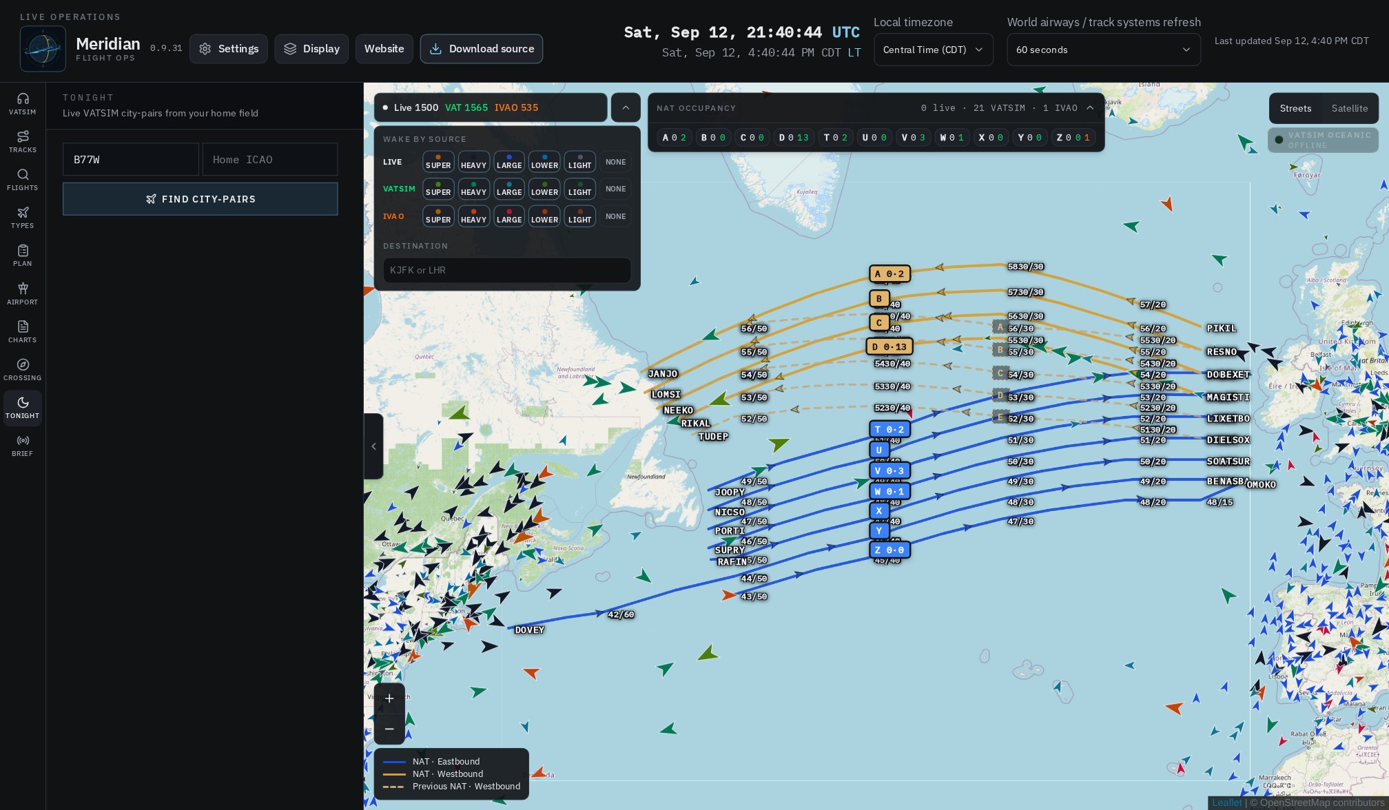
Tonight: live VATSIM city-pairs from a home field

A night on the desk · 5

What people are actually flying.

Tonight is not a random generator. Home field KLAX, optional airframe. It lists VATSIM city-pairs leaving that area right now — UA81A KLAX–EGKK — and why it matched. Tap to plot. Hand it to Crossing if the ocean is the point.

  • Live network pairs, not a canned weekend list
  • Filter by type when you care what you are sitting in
  • Quiet network? Crossing still works
VATSIM FIR and approach polygons over Europe in Meridian

VATSIM airspace

Coverage you can read from altitude.

Centers and approach use published boundaries. Europe lights up as FIR polygons, not a spray of circles. On the field the letters are D, G, T, A — delivery, ground, tower, ATIS — clickable without hunting a pixel. Aircraft always win the click.

  • Positions are multi-select in Display
  • Station card: controller, time up, ATIS text
  • Listen stays in the rail after you sign in with VATSIM
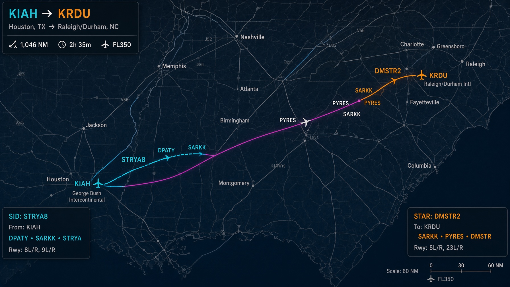
SID and STAR geometry on a filed route in Meridian

Procedures

The SID as filed. Not a straight line.

Waypoints resolve along the route, not the nearest duplicate on another continent. Airways expand. When the flight is SID and STAR, the magenta body does not glue the two airports together. SimBrief OFP and a pasted ICAO string both decode.

  • One filed transition — not every transition in the book
  • Looked-up flights and imported plans can sit together
  • Unload the import when you are done
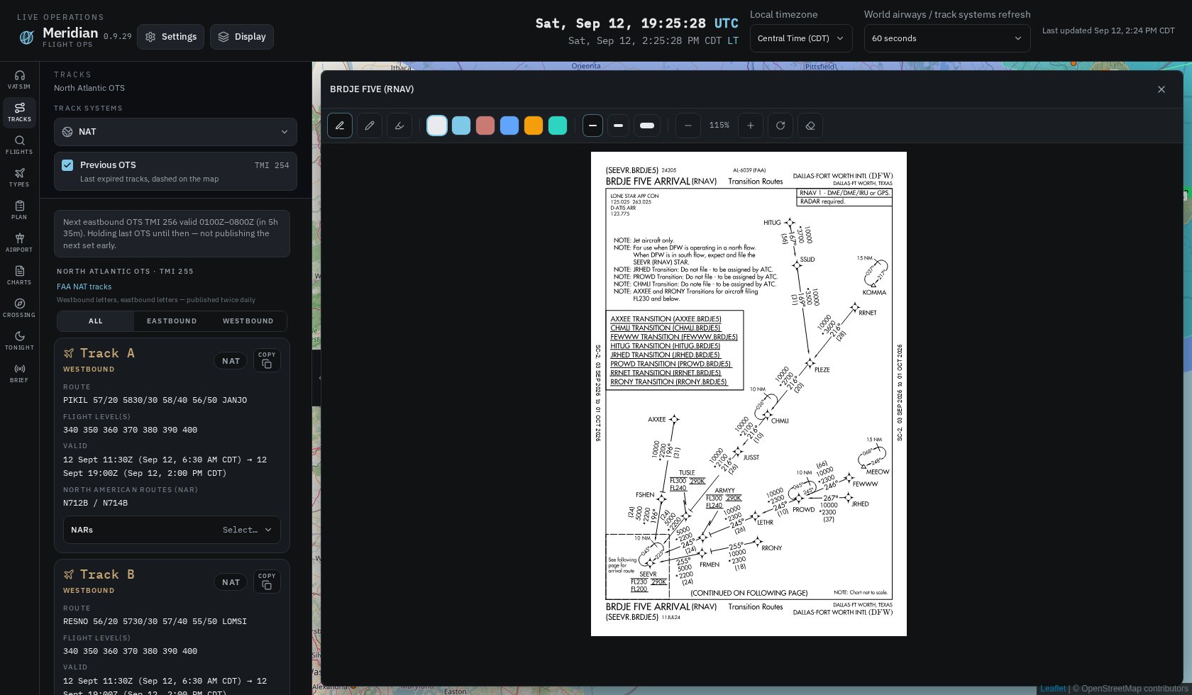
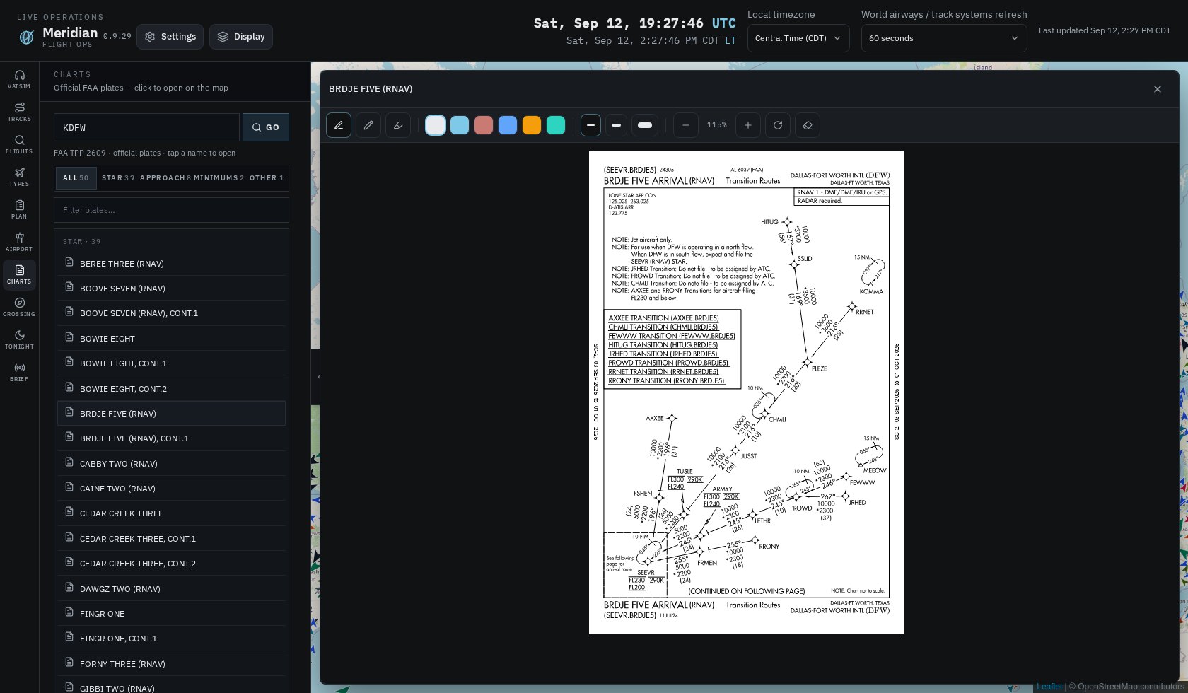
KDFW BRDJE FIVE RNAV STAR plate open in Meridian

Charts

The plate, when you need the plate.

Official FAA TPP — BRDJE FIVE at DFW is the messy STAR on purpose. Annotate it. Close it. Occupancy and the flight you were watching are still there. US plates. We do not pretend this is Navigraph.

  • SID, STAR, approach, taxi, minima — filter the list
  • Current 28-day cycle stamped on the plate · Not for navigation
  • US FAA TPP only — not Europe, not Navigraph

In the window

What 0.10.8 actually contains.

Track systems
NAT · PACOTS · EUR/SAM · NOPAC · previous · future
Traffic
REAL ADS-B · VATSIM · IVAO · PilotEdge · wake Super–Light
ATC
Published FIR / TRACON · D G T A on the field
Crossing
Organised track + NAR + FIR strip + copy
Airframes
Photo catalog · airborne list by ICAO type
Charts
Official FAA TPP, US, current 28-day cycle
Weather
RainViewer radar · NASA GIBS / EUMETSAT vis & IR
Map
MapTiler satellite + streets v4 · search · dark streets
Simulator
MSFS 2020 / 2024 SimConnect ownship on desktop

Documentation

How the desk actually works.

The same rules the Windows program follows. This is not a substitute for running Meridian.

Get Meridian

The Windows program. Not a tab.

Meridian 0.10.8. This homepage does not open the desk. There is no “open in browser.” You download a Windows build and run it as a window on your PC.

v0.10.8

Meridian 0.10.8 for Windows

Native host (C# + WebView2). About 76 MB. Unzip, open desktop, run with .NET 8. Settings → About inside the app matches this version. A signed Setup.exe is the 1.0 packager — 0.9 is this zip.

  1. Download the zip from this page.
  2. Unzip it somewhere you keep programs.
  3. Open the desktop folder.
  4. Run dotnet restore then dotnet run, or open NATViewer in Visual Studio.
Download 0.10.8 for Windows

FAQ

Straight answers.

No. This page is the public homepage: what it is, how it works, documentation, and the Windows download. The product is a C# + WebView2 window on your PC. There is no “open the app” link here on purpose.

Meridian 0.10.8 for Windows — a zip, about 76 MB. Unzip, open the desktop folder, dotnet restore then dotnet run. You need Windows 10 or 11, the .NET 8 SDK, and WebView2 (already on most Windows 11 machines).

No, and we do not claim it does. Real aircraft come from public ADS-B (adsb.lol) plus VATSIM, IVAO, and PilotEdge. Density will never match a paid tracker.

Not in this version. US FAA Terminal Procedures (TPP) are in the Charts workspace. Chart vendors require their own login; Meridian will not collect those passwords.

Never. Sign in with VATSIM loads VATSIM’s own page inside the left rail. Audio is listen.vatsim.net. We never see a CID or a password.

Yes. Crossing, Flights, Airport, and Charts are built for a 40-minute sector as well as KJFK–EGLL.

On the Windows desktop build, yes — SimConnect for MSFS 2020 and 2024, with an optional ownship trail. The simulator does not have to be running for the ops desk to work.

Meridian 0.10.8 is free to download from this page while 0.9 is the current desk. If 1.0 is paid, the price will be on this page with that build.

On your PC only: %LOCALAPPDATA%\Meridian\logs. Settings → About → Open logs folder. We do not collect them.